Seismic sensing can track the magnitude, velocity and debris contents of floods
14 October 2022
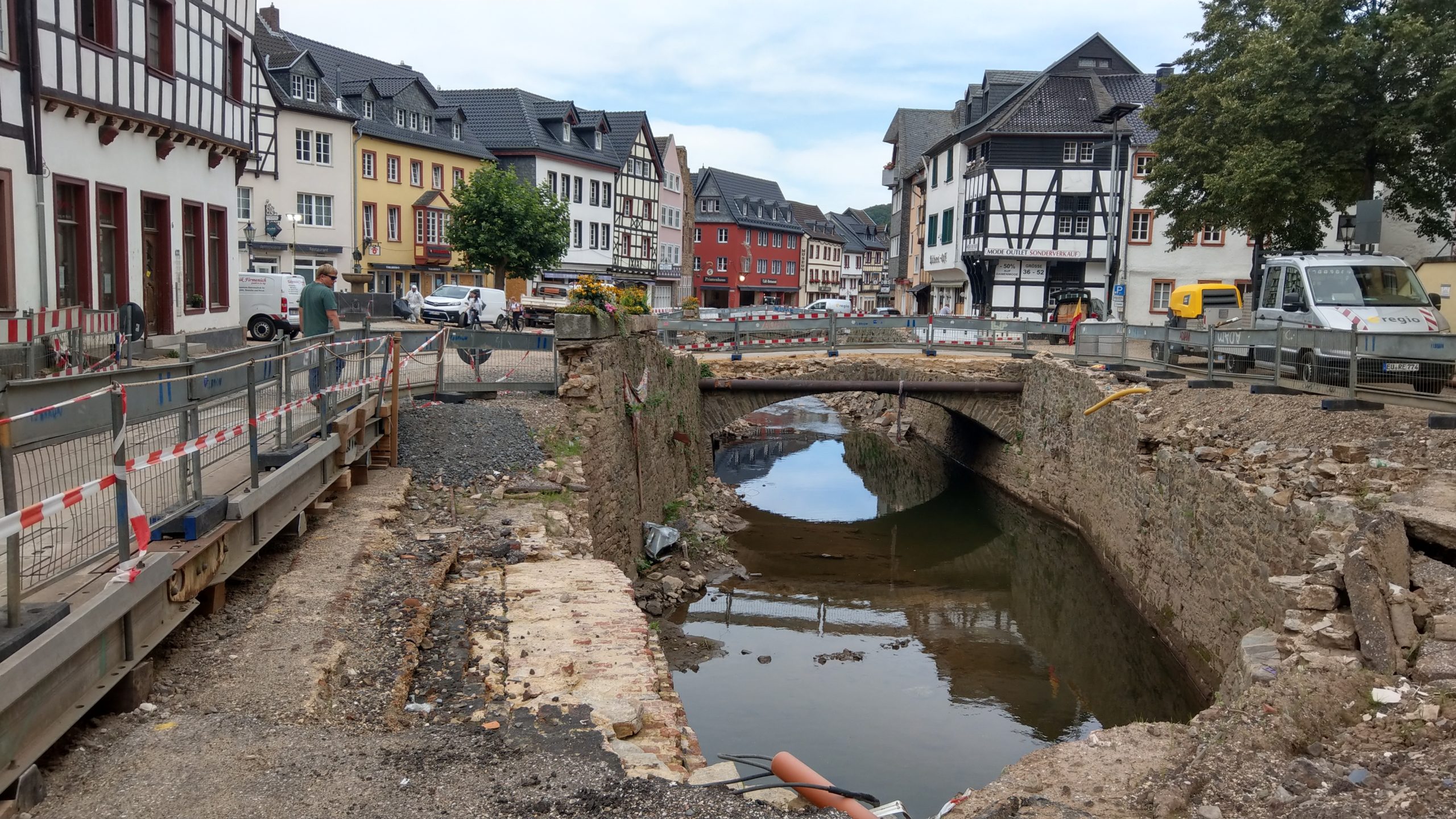
Seismic sensors could provide improved warning for rapidly evolving valley floods, according to new research published in Geophysical Research Letters. The study focused on Germany’s Ahr Valley region, which in 2021 was devastated by severe river flooding. Credit: Michael Dietze
AGU press contact:
Rebecca Dzombak, [email protected], +1 (202) 777-7492 (UTC-4 hours)
Contact information for the researchers:
Michael Dietze, University of Göttingen, +49 (0)551 39 4570, [email protected] (UTC+2 hours)
WASHINGTON — Rapid floods are a significant and growing hazard worldwide, but their intensity and evolution are currently difficult to track. Seismic sensors, already in place to detect earthquakes, could sense floods, monitor their rapid changes and act as an early warning system to minimize damage and save lives, according to new research published in Geophysical Research Letters.
Many floods in river valleys are monitored by river gauges, which can coarsely track a flood’s water level. However, gauges may be sparse, update infrequently and risk being washed away by a flood. Seismic stations are installed at safe distance from streams and sense not only ground shaking due to earthquakes, but also vibrations from explosions, landslides, storms and floods.
Previous research into seismic flood monitoring has been limited to detecting a flood and indirectly tracking its evolution, particularly for glacial floods. The new study goes one step ahead, using seismic signals to estimate flood velocity, water level and debris, said Michael Dietze, lead study author and a scientist at the University of Göttingen. “This study paves the way for real-time flood anatomy, with values that can be used by partners” to provide real-time risk updates, Dietze said.
Geophysical Research Letters is AGU’s journal for short-format, high-impact research with immediate implications that span the Earth and space sciences.
The researchers reconstructed the fatal propagation of a disastrous 2021 flood in Germany, which killed nearly 200 people. The team used an existing earthquake seismometer station near the flood’s path as a flood detection and tracking tool. These seismic data were the only systematic source of quantitative information about how the flood evolved because three existing water level stations along the main river were destroyed early on.
The team found the seismometer illustrated the track of the flood for one hour as floodwaters ploughed through the steep, winding Ahr valley, south of Cologne. By combining mathematical models, the researchers were able to estimate the speed with which the flood moved, to extract information about the rising water level, and to estimate the amount of debris — such as gravel, cars and oil tanks — that were being swept away by the flood.
Measuring the “seismic footprint” of a flood — its magnitude, velocity and trajectory — in real time could be used for future flood protection, providing information necessary to optimize models of flood behaviour for warning and rescue initiatives.
“If the data stream from that station had been available and analysed as our research now shows, essential real time information on the magnitude and velocity of the flood would have been available,” said Dietze. “As 10 percent of Europe’s surface area is prone to rapid flooding by rivers confined in valleys, we may want to start thinking about new ways of flood early warning. The current network of water level stations is not enough to be adequately prepared for future events.”
Dietze and colleagues are currently working on a plan to identify further areas at risk of flooding and equip them with low-cost “watch tower” seismometer pairs. Using two or more seismic sensors, rather than a single sensor as in the study, would provide scientists more robust information, Dietze said. Installing such “watch towers” would cost a fraction of a percent of the damage caused by future floods, according to the researchers.
“The catastrophic flood that hit the Ahrtal in Germany in July 2021 revealed to residents, politicians, emergency services and scientists how much we need to learn to improve current flood warning systems,” Dietze said.
# # #
AGU (www.agu.org) supports 130,000 enthusiasts to experts worldwide in Earth and space sciences. Through broad and inclusive partnerships, we advance discovery and solution science that accelerate knowledge and create solutions that are ethical, unbiased and respectful of communities and their values. Our programs include serving as a scholarly publisher, convening virtual and in-person events and providing career support. We live our values in everything we do, such as our net zero energy renovated building in Washington, D.C. and our Ethics and Equity Center, which fosters a diverse and inclusive geoscience community to ensure responsible conduct.
Notes for Journalists:
Download a PDF copy of the paper here. This paper is published with open access and is freely available.
Paper title:
“A seismic approach to flood detection and characterization in upland catchments”
Authors:
- Dietze (corresponding author), Georg-August-University Göttingen, Geosciences and Geography, Göttingen, Germany; GFZ German Research Centre for Geosciences. Section 4.6 Geomorphology, Potsdam, Germany
- Hoffmann, R. Bell, L. Schrott, University of Bonn, Department of Geography, Bonn, Germany
- Hovius, GFZ German Research Centre for Geosciences. Section 4.6 Geomorphology, Potsdam, Germany; University of Potsdam, Institute of Geosciences, Potsdam, Germany