Climate change and a lack of infrastructure funds put coastal airports at risk in the US
10 December 2023
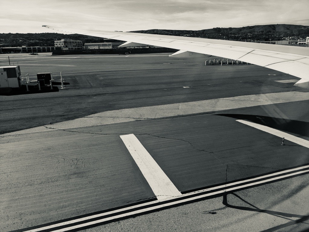
San Francisco’s runways are sinking more rapidly than 14 other major coastal airports, according to new research to be presented at #AGU23 this week. Credit: Liza Lester
AGU press contact:
Rebecca Dzombak, [email protected] (UTC-5 hours)
Contact information for the researchers:
Oluwaseyi Dasho, Virginia Tech, [email protected] (UTC-5 hours)
SAN FRANCISCO — After measuring minute elevation changes on runways at 15 coastal airports around the United States, researchers found that of airport runways sinking, or subsiding, San Francisco (SFO) tops the subsidence chart at nearly 10 millimeters (0.4 inches) per year, while Los Angeles International Airport (LAX) is the slowest.
America’s crumbling roads and sagging bridges have garnered attention over the past few years, prompting the passing of the Infrastructure Investment and Jobs Act in 2021. But the nation’s runways are also feeling their age, posing serious hazards to the millions of travelers who fly every day, researchers say.
“The funding to maintain airport infrastructures is quite limited, so many are getting dilapidated,” said Oluwaseyi Dasho, an environmental hazard specialist at Virginia Tech.
Dasho and his advisor, Manoochehr Shirzaei, wanted to better understand how coastal airports’ runways, roads and other transportation infrastructure are fairing. “U.S. airport infrastructure needs attention, especially focusing on runways,” Dasho said. They measured subsidence, or the slow sinking of the ground surface, because cracks or bulging on runways can cause serious accidents for passengers and flight crews. Shifts that seem small on an annual basis can quickly add up.
In a new study presented on 14 December at AGU’s Annual Meeting in San Francisco, researchers surveyed the infrastructure of 15 coastal airports in the United States over a 7-year time frame (2015-2022). They used European Space Agency’s Sentinel-1 radar satellite to measure surface elevation at an unprecedented submillimeter scale — ideal for measuring small-scale changes in shifting infrastructure.
“It’s the first subsidence data set ever created for U.S. airports runways,” said Shirzaei, an environmental security expert at Virginia Tech, adding that such vertical accuracy can allow them to measure “very tiny deformation, such as the deformation of the ground from thawing and freezing.”
Subsidence rates varied among the 15 sites studied, but all had observable changes. Of these airports, San Francisco International Airport had the fastest subsidence rate of -9.6 millimeters per year (0.38 inches per year). In comparison, Los Angeles International Airport had the slowest rate (1.7 millimeters per year, or around 0.07 inches per year).
Out of the nearly 7 million square meters (1,718 acres) of runway analyzed, the researchers found that more than 96% were at low risk of damage due to subsidence, and 0.3% of runway areas (about 13,825 square meters, or 3.5 acres) are at high or very high risk of damage, notably at Ronald Regan International Airport in Arlington, Va., and two Florida airports, Tampa International and Orlando International Airport.
While the infrastructure bill allocated billions of dollars for updating U.S. infrastructure, Dasho pointed out that the demand and need for maintenance updates far exceeds this budget. This research might help policymakers allocate limited funds.
“Prioritizing infrastructure allows equitable transportation infrastructure, particularly enabling underserved and socially vulnerable communities to develop and apply adaptation and mitigation strategies in the face of climate change,” he said.
Shirzaei agreed, adding, “This technology will tell you very clearly which infrastructure and where is in the worst condition and needs attention first.”
#
Abstract information:
NH43B-0793 Sinking Airports: A Glance to State of U.S. Infrastructure
https://agu.confex.com/agu/fm23/meetingapp.cgi/Paper/1298728
Thursday, 14 December 2023, 17:10-21:30, Poster Hall A-C
#
AGU’s Annual Meeting (#AGU23) will bring more than 25,000 Earth and space scientists to the Moscone Center in San Francisco, California, and online everywhere from 11-15 December. Members of the press or public information officers can request complimentary press registration for the meeting now through the end of the conference.
See more local stories like these on our California tipsheet:
Storms like 2023’s “snow deluge” less likely due to climate change
Parts of California experienced extreme snowfall in the winter of 2023. Research shows that this once-in-a-lifetime event is likely to become even less common under future climate scenarios.
Friday, 2:23 PM 3011 – West
Stream restoration is for the rich
Stream restoration in urban areas brings benefits to urban ecosystems. But many of these projects may focus on more affluent parts of the city.
Friday, 8:30 AM Poster Hall A-C – South
Progress on restoring large wetland near Lake Tahoe
A majority of the Sierra Nevada’s high-elevation wetlands have been degraded by activities such as logging and grazing. An effort is ongoing to restore the 485-acre Van Norden Meadow near Lake Tahoe; one year in, the team is providing the first updates on the meadow’s hydrologic health.
Friday, 4:52 PM 2001 – West
Poor neighborhoods may have a higher risk of warehouse and transportation pollution
Researchers examined data from NASA to find how pollution originating from high concentrations of warehouses and transportation might affect different neighborhoods in Southern California. They found that socially disadvantaged or historically marginalized communities were disproportionately affected.
Thursday, 8:30 AM Poster Hall A-C – South
Heat waves cause uptick in emergency hospital visits for California infants
The hottest heat waves result in the most emergency hospital visits in infants less than one year old in California. Analysis shows that heat exposure most affected term infants and those with lower parental education.
Tuesday, 2:27 PM eLightning Theater VI, Hall D – South
Disadvantaged communities in US breathe 8.5% more fine particulate pollution
Disadvantaged communities have long felt the effects of poorer air quality due to pollution. But how much fine pollution is in the air of these communities, on average, and what pollutants are the cause of it, both in Californian cities and in the U.S. at large.
Friday, 8:30 AM Poster Hall A-C – South