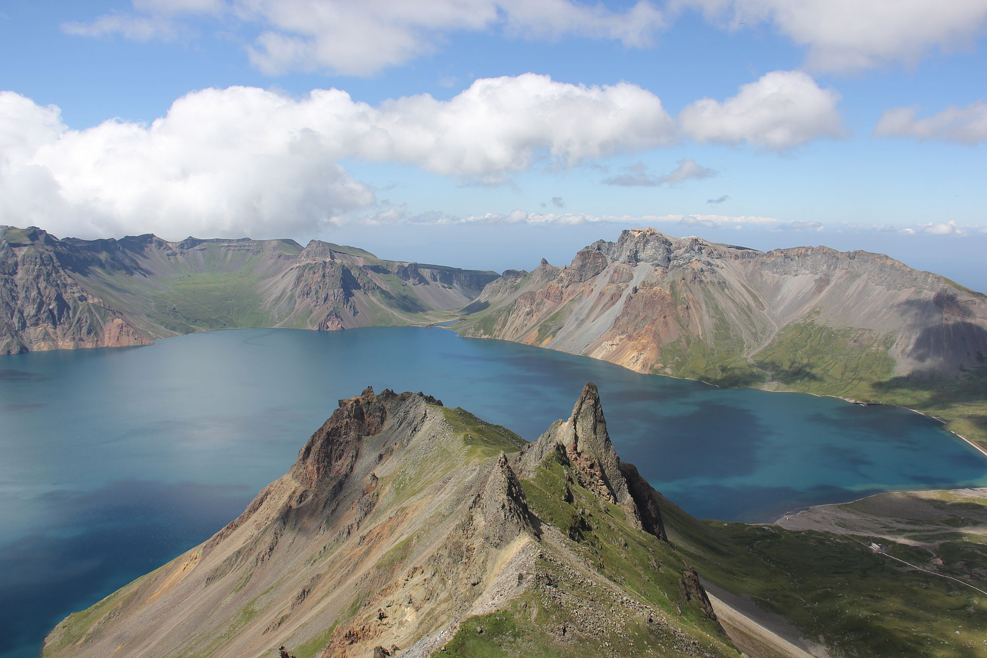
The Paektu (Changbaishan) Volcano is located on the border of China and North Korea. An eruption of the volcano over one thousand years ago was likely larger than the 1815 Tambora eruption, which created “a year without a summer” when huge quantities of volcano debris were blasted into the atmosphere. Credit: Wikimedia commons/ Laika ac/ CC BY-SA 2.0
.jpg )
Featured Research
Tree rings reveal climate impacts of the Paektu (Changbaishan) Volcano’s “Millennium Eruption”
The “Millennium Eruption” of the Paektu Volcano on the border of China and North Korea lowered temperatures and changed precipitation patterns across Asia, new research reveals. Researchers used tree rings, historical records and comparisons between ice core and petrogeochemical data to determine climate impacts and revise the date of the eruption from 946 to 945 CE. [JGR Atmospheres research]
Climate change, fires and deforestation have shrunk carbon stores in the West
The total mass of living trees and plants declined by up to 25% across the western United States between 2005 and 2019, most likely due to fire, drought and deforestation. During that time, the Pacific Northwest had the greatest total live carbon, or living plant matter, while the Southwest had the least. [Earth’s Future research][Cary Institute press release]
Small hydropower plants need to plan for drought, economic instability
Climate change is expected to increase the frequency of droughts in some parts of the world. New research finds that small hydropower plants should account for variable water levels and socio-economic factors to be reliable and financially viable in the future. [Water Resources Research research]
AI can help distinguish between earthquakes and explosions
Earthquakes and explosions both send acoustic waves through the ground and the air, making it hard for detection stations to differentiate what caused the waves. A new AI model uses inputs from both seismic (ground-based) and infrasound (air-based) waves to determine the source of disturbances on the Korean Peninsula. [Geophysical Research Letters research]
Woody plants’ ranges across the Great Plains will shift as the climate warms
The spread of trees and other woody plants into grasslands in Texas, Oklahoma and Kansas limits the amount of land available for cattle and reduces the region’s water supply. As the climate continues to warm, honey mesquite will spread farther north and east into the Great Plains, while the ranges of other woody plants in the region will decrease, new research finds. [Earth’s Future research]
Mosquitoes without borders
Using regional systems based on ecology, not geopolitical boundaries, can give scientists a better picture of the potential spread of West Nile virus. [Eos research spotlight][GeoHealth research]
###