6/21/2023: Climate cooling strategy may raise wildfire risk in some areas

American Geophysical Union21 June 2023

Featured research

Climate cooling strategy may raise wildfire risk in some areas

Scientists have proposed injecting aerosols that reflect sunlight into the stratosphere to cool global temperatures. But this climate intervention method could actually increase wildfire risk in some regions such as western Central Africa. [Earth’s Future research]

South Asia and Africa to face increased lung cancer risk due to biomass burning

Organic matter is burned during biomass fuel consumption and other activities, creating a cancer-causing byproduct known as polycyclic aromatic hydrocarbons (PAHs). Future changes in emissions and climate may increase PAH-associated risks in south Asia and Africa by 2050. [Earth’s Future research]

Rising temperatures limit mobility in densely populated areas

A study found that people in San Francisco were less likely to leave their homes due to excessive heat during the COVID-19 pandemic, noting the role of local temperature during a period of already restricted mobility. Lower-income communities were found to be less likely to change their day-to-day mobility than higher-income communities. [GeoHealth research]

Three Gorges Dam turned China’s largest freshwater lake into a carbon sink

The Three Gorges Dam has dramatically altered the surrounding ecosystem, including lowering Poyang Lake’s water level. This has allowed for an expansion of carbon-absorbing wetland vegetation. As a result, the country’s largest freshwater lake has changed from a carbon source to a carbon sink as the surrounding greenery sequesters carbon dioxide. [Geophysical Research Letters research]

Mapping beaver dams with machine learning

Beavers are ecosystem engineers, altering the landscape and ecosystems as they build their dams. Scientists are using machine learning to detect beaver dams across the United States and learn more about their impacts to local environments. [JGR Biogeosciences research] [Eos Editor’s Highlight]

*** Visit the AGU Newsroom to register for access to AGU journals and find experts and featured research in various topic areas. Visit eos.org to read Research Spotlights and Editors’ Highlights.

***   AGU (www.agu.org) is a global community supporting more than half a million advocates and professionals in Earth and space sciences. Through broad and inclusive partnerships, AGU aims to advance discovery and solution science that accelerate knowledge and create solutions that are ethical, unbiased and respectful of communities and their values. Our programs include serving as a scholarly publisher, convening virtual and in-person events and providing career support. We live our values in everything we do, such as our net zero energy renovated building in Washington, D.C. and our Ethics and Equity Center, which fosters a diverse and inclusive geoscience community to ensure responsible conduct.

6/14/2023: Bold prescribed burns could ease smoke in cities and vulnerable rural communities

American Geophysical Union14 June 2023

AGU News

Wildfires Special Collection for all your fire reporting needs

Explore AGU’s “Fire in the Earth System” special collection, which brings together more than 100 studies on wildfires past, present and future. It’s a great resource for digging up background information, discovering new angles and finding new sources for wildfire. [Peruse the Special Collection]

Featured video

The “hole” in the bottom of the sea

The Indian Ocean Geoid Low is the deepest dent in Earth’s gravitational field, but how did it get there? Researchers tackled this question in a new study and found that sinking slabs of an ancient oceanic plate deep into the mantle beneath Africa could be to blame.  [Video][Geophysical Research Letters research]

Featured research

Prescribed burns could reduce smoke exposure in vulnerable rural communities

The U.S. West Coast experiences frequent wildfires, threatening air quality for the region’s most vulnerable communities. Large-scale prescribed burning could mitigate this crisis and reduce the amount of smoke in rural communities and dense population centers across the West. [Harvard press release] [Earth’s Future research]

Large Greenland glacier at risk of melting

Scientists thought one of the largest glaciers in Greenland was stable; while ice around it has shrunk, it’s remained about the same size. But new analyses reveal subglacial channels are growing, suggesting the glacier is more vulnerable to climate change and melt than previously thought. [Geophysical Research Letters research]

Aerosols unexpectedly make parts of the ocean warmer While most of the ocean cools when aerosols are added into the atmosphere, parts of the Southern and North Atlantic oceans actually get warmer, a new study finds. The change in temperature depends on ocean currents, sea ice, the concentration of aerosols and where they are being emitted from. [JGR Oceans research]

Send in the drones: safely monitoring volcanic gas emissions

Scientists are sending drones into the plumes of active volcanoes to measure volcanic gases. The team tested this approach at Bagana Volcano in Papua New Guinea and are hoping to use drones to monitor more inaccessible volcanoes in the future. [Geochemistry, Geophysics, Geosystems research] [Eos editor’s highlight]

*** Visit the AGU Newsroom to register for access to AGU journals and find experts and featured research in various topic areas. Visit eos.org to read Research Spotlights and Editors’ Highlights.

***   AGU (www.agu.org) is a global community supporting more than half a million advocates and professionals in Earth and space sciences. Through broad and inclusive partnerships, AGU aims to advance discovery and solution science that accelerate knowledge and create solutions that are ethical, unbiased and respectful of communities and their values. Our programs include serving as a scholarly publisher, convening virtual and in-person events and providing career support. We live our values in everything we do, such as our net zero energy renovated building in Washington, D.C. and our Ethics and Equity Center, which fosters a diverse and inclusive geoscience community to ensure responsible conduct.

Tracking ancient earthquakes by taking the temperatures of faults

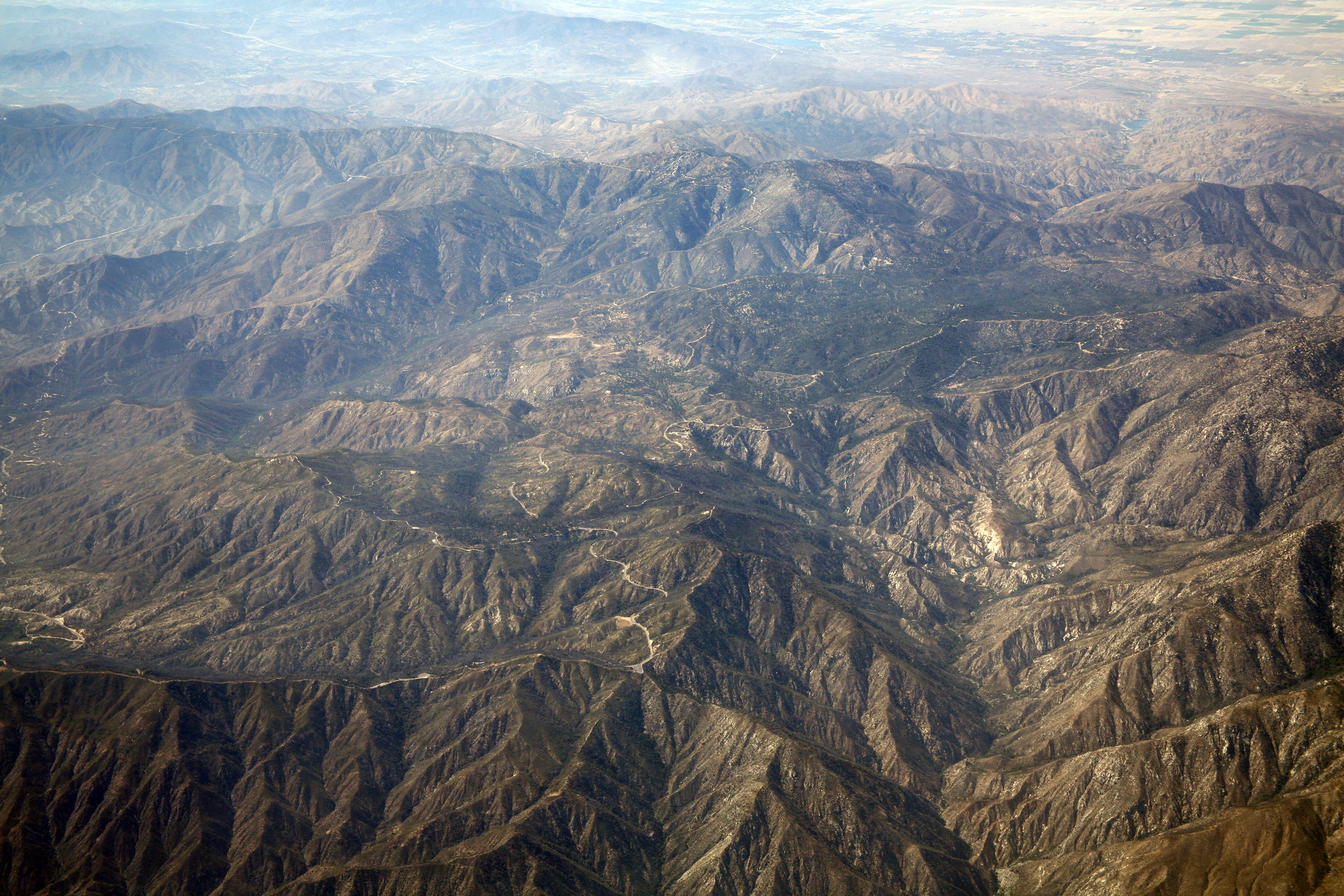
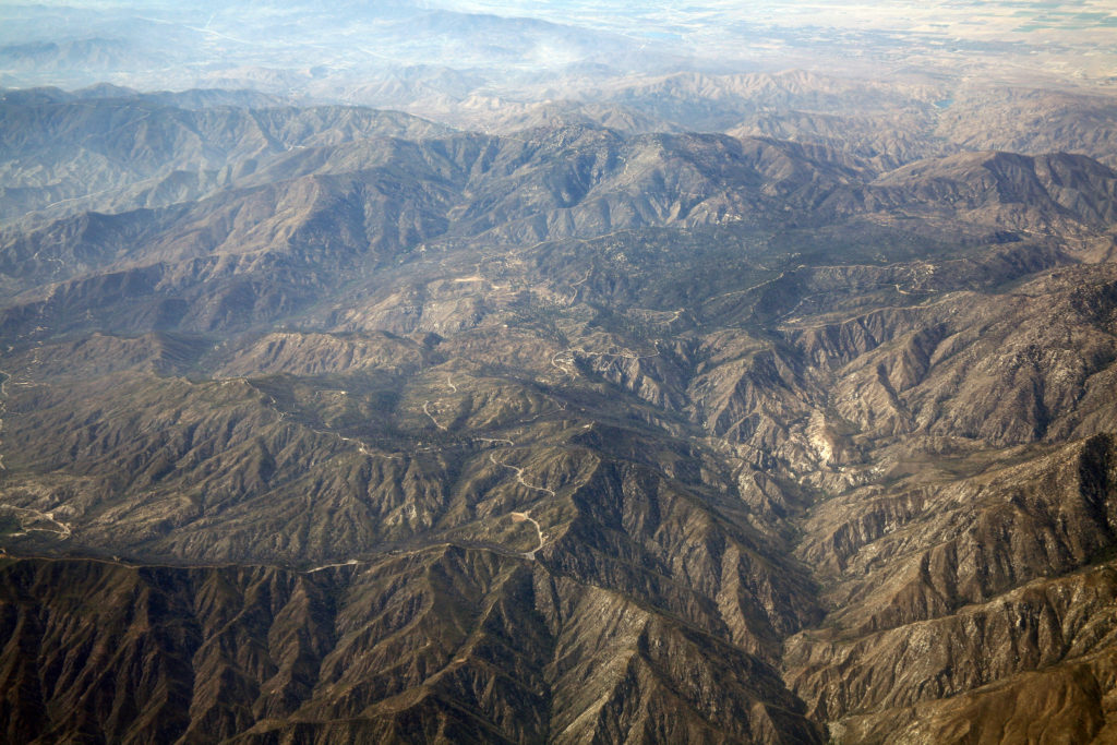
The Punchbowl fault, an inactive “paleo-San Andreas fault,” is nestled in the San Andreas mountains. In a new study, scientists use resistant zircon mineral grains to take the temperature of the fault, identifying ancient earthquakes and estimating how much energy was release in the rupture. Credit: Doc Searles

AGU press contact:
Rebecca Dzombak, +1 (202) 777-7494, [email protected] (UTC-4 hours)

Contact information for the researchers:
Emma Armstrong, Utah State University, [email protected] (UTC-6 hours)
Alexis Ault, Utah State University, [email protected] (UTC-6 hours)


Understanding ancient earthquakes helps researchers estimate the hazards posed by modern earthquakes. Reported in a new study, geologists have come up with a new way to estimate intensity of these old events: take their temperature.

During an earthquake, the temperature within a fault rises as the two sides slide past another. To get a close look at quake temperatures, the new Geochemistry, Geophysics, Geosystems study repurposed a backbone method of tectonics: zircon-based thermochronometry, where the amount of helium lost from a mineral grain is related to how hot it got.

The method is typically used to constrain Earth processes operating at scales of kilometers and millions of years as mountain ranges are built and destroyed, but the researchers applied it at smaller scales than ever before to detect earthquake temperatures.

“We’re pushing this technique to its limits,” said Emma Armstrong, lead author of the study and a thermochronologist at Utah State University. “There haven’t been many studies done on short-duration, high-intensity events, or at these small spatial and temporal scales. We’re talking about seconds of temperature rise here,” she said.

Zircons and other minerals within the thin band of damaged material in a fault can record the brief, intensely hot temperatures rocks reach during a quake. Organic molecules preserved there do, too. Scientists can compare zircon and organic molecule records to pinpoint past earthquakes and see just how hot it got inside the fault during these ruptures, telling them how much energy was released.

The researchers tested their technique at the Punchbowl fault, a major inactive fault that parallels the active San Andreas fault in the Los Angeles area. “A paleo-San Andreas fault” that was active several million years ago, as study co-author and Utah State University thermochronologist and earthquake geologist Alexis Ault described it. Previously, co-authors Heather Savage, an earthquake geologist, and Pratigya Polissar, a geochemist, both at University of California Santa Cruz, used the organic molecule technique on the same rocks.

In the new study, the researchers aimed to see how well the two techniques agree across the fault, testing how widely fault temperatures could have varied during earthquakes.

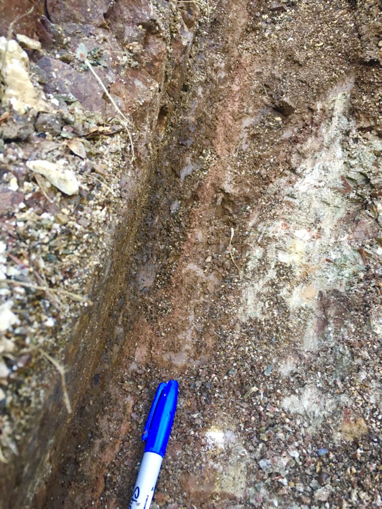
When a fault ruptures, the most intense damage can be confined to a narrow strip of rock just a few centimeters wide, as seen in the Punchbowl fault here. Credit: Alexis Ault

The researchers used tiny samples of damaged fault rocks, called fault gouge, from within a two- to 10-centimeter band at the heart of the fault’s deformation, as well as the 10 centimeters surrounding it. To estimate the earthquake’s temperatures during the fault’s last rupture, the team analyzed zircons, which are resilient minerals that can withstand the intense conditions of an earthquake. By measuring how much helium was left in the fault’s zircon crystals, they estimated the fault reached temperatures around 700 degrees Celsius in the past, which could indicate large-magnitude earthquakes.

The zircon-based temperature range overlaps with previous estimates based on organic material, around 450 to 1050 degrees Celsius, but also refines previous estimates of earthquake temperatures. This suggests that if one method is not available for taking an earthquake’s temperature, scientists could apply the other. The researchers also found that temperature varied along the fault, correlating with the width of that narrow band of intensely deformed rock.

“We theoretically predicted this, but it’s not commonly observed in real datasets,” said Ault. “So to show that and support prior work was exciting.”

Armstrong and Ault are eager to try this new earthquake-thermometer method on other important faults and aim to incorporate other data to further hone estimates for ancient quakes’ temperatures and magnitude.

“Zircon thermochronometry is a classic tool that we can use in new ways to identify what could have been a catastrophic event in the geologic past that is otherwise cryptic today,” said Armstrong.

###

AGU (www.agu.org) supports 130,000 enthusiasts to experts worldwide in Earth and space sciences. Through broad and inclusive partnerships, we advance discovery and solution science that accelerate knowledge and create solutions that are ethical, unbiased and respectful of communities and their values. Our programs include serving as a scholarly publisher, convening virtual and in-person events and providing career support. We live our values in everything we do, such as our net zero energy renovated building in Washington, D.C. and our Ethics and Equity Center, which fosters a diverse and inclusive geoscience community to ensure responsible conduct.


Notes for Journalists:

This research study is published with open access and is freely available. Download a PDF copy of the paper here. Neither the paper nor this press release is under embargo.

Paper information:

“A Multi-Proxy Approach Using Zircon (U-Th)/He Thermochronometry and Biomarker Thermal Maturity to Robustly Capture Earthquake Temperature Rise Along the Punchbowl Fault, California”

Author information:

  • E.M. Armstrong (corresponding author), Alexis K. Ault, K.K. Bradbury, Department of Geosciences, Utah State University
  • H.M. Savage, P.J. Polissar, Department of Earth and Planetary Sciences, University of California Santa Cruz
  • S.N. Thompson, Department of Geosciences, University of Arizona