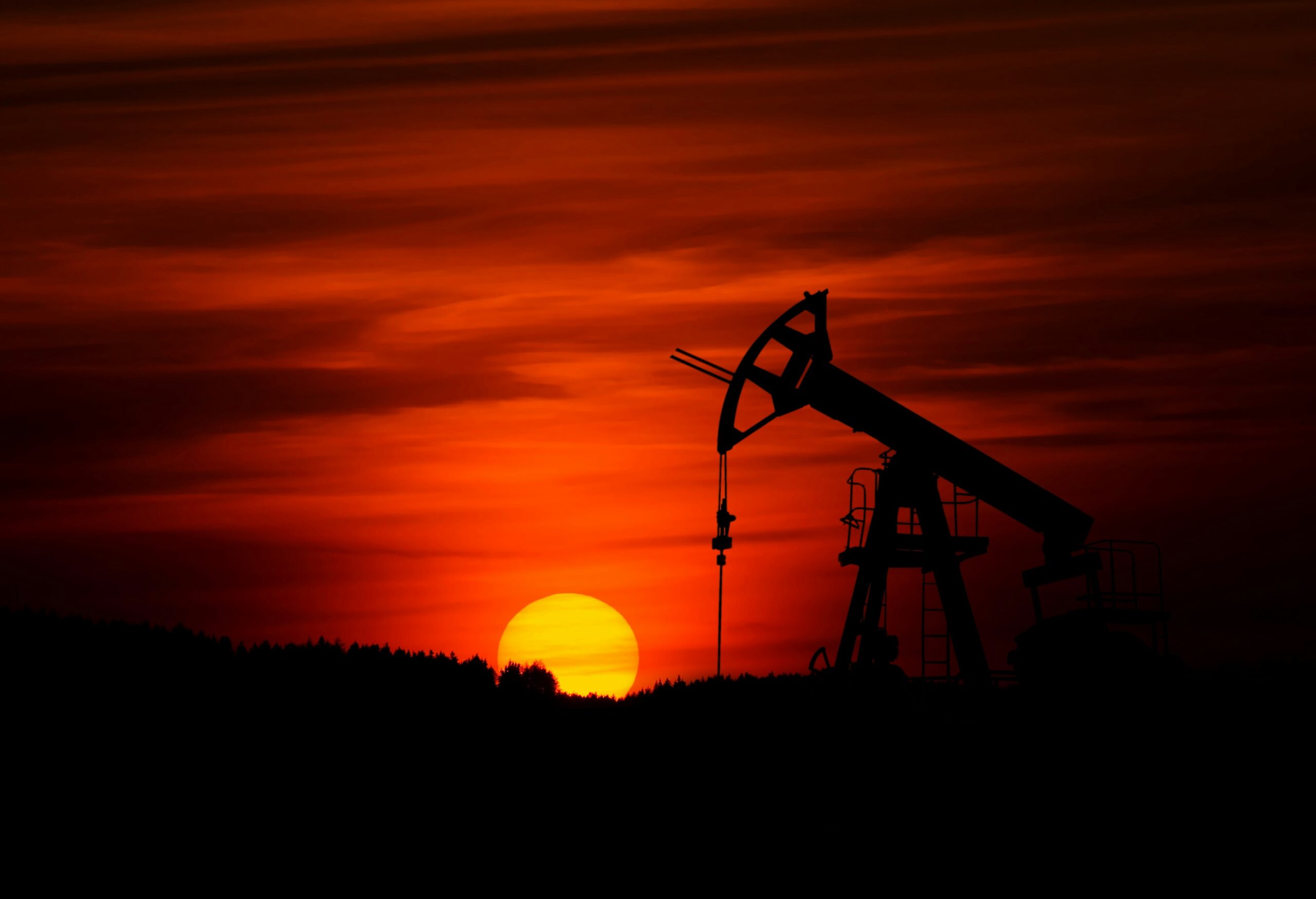
An oil derrick pumping crude oil out of the ground. A new study calculates how much the world’s biggest fossil fuel emitters, including countries like the U.S. and companies like Chevron and ExxonMobil, are contributing to increased extreme weather event risk. Credit: Zbynek Burival on Unsplash
Featured Research
Research Roundup: How urban environments are shaping extreme rainfall
- Tropical cities need to prepare for future intense rainfall as the climate warms [Earth’s Future study]
- How cleaner air is worsening Europe’s most extreme rainstorms [Geophysical Research Letters study]
- Growing coastal cities make tropical cyclones wetter downwind [JGR Atmospheres study]
Here’s how much major emitters have raised the risk of extreme weather
Carbon dioxide emissions from the ten highest-emitting private fossil fuel producers, led by Chevron and ExxonMobil, made the 2021 heatwave in the U.S. Pacific Northwest 31% more likely and the extreme rains of 2022 in Pakistan 7% more likely. Meanwhile, the U.S.’s total carbon emissions up to 2020 have raised the odds of the most extreme heat events recorded since then by 50% for a third of the world. A new study proportionally links cumulative carbon emissions to increased chances of intense rain or heat, allowing scientists to infer major emitters’ contributions to the heightened risk of extreme weather events based on their known carbon emissions. The method may offer a way to gauge major emitters’ liabilities for the impacts of extreme weather, improving climate accountability. [Earth’s Future study]
Marine acidic heatwaves now up to four times more likely than by chance
Simultaneous marine heatwaves and extreme acidification events now strike four times more often in the low-to-mid-latitudes than scientists would expect by chance alone, according to a study of ocean observations from 1982 to 2024. Most of these combos span less than a few hundred thousand square miles for under a month, but notable exceptions exist: the “blob” that occupied over 4.8 million square miles of the northeastern Pacific in 2015 and the acidic heatwave that persisted in the Atlantic for almost a full year in 2023 and 2024. Scientists expect these double extremes, which stress marine life more than high heat or acidity alone, to grow more severe as baseline ocean conditions overall become warmer and more acidic. [Eos research spotlight] [AGU Advances study]
Plants are hiding their water stress by getting leafier
Drought frequency from 1981 to 2018 has been underestimated across two-thirds of the globe, according to a new study of plant water usage. During drought, plants can’t draw enough moisture from the soil to meet their needs, so they emit less water from their leaves through evapotranspiration than usual. By using satellite measurements of leafiness and plant water loss to account for this process, researchers found that plants struggled with water shortfalls 14% more of the time in 2018 than in 1981. This newly revealed water stress complicates the apparent growth spurt of plants in recent decades, attributed to CO2 emissions. More CO2 in the atmosphere encourages plants to increase their leaf area, making the Earth look greener in satellite images despite widespread underlying drought. [AGU Advances study]
Miniature Martian ruby and sapphire relatives likely forged by meteor impacts
The Perseverance Rover has stumbled upon tiny grains of corundum — a mineral that forms rubies and sapphires depending on its chemistry and color — within unassuming rock fragments strewn across the floor of Jezero Crater on Mars. Given corundum’s rarity on Earth, finding it on Mars came as a major surprise. Scientists think the crystals likely formed in the intense pressure and temperature conditions of a large impact, potentially the event that formed the 28-mile-wide (45-kilometer-wide) Jezero Crater itself. Sadly, the mineral won’t be much good for Martian jewelry as Perseverance’s measurements suggest each piece is likely only a tenth of the size of a flea. [Geophysical Research Letters study]
This rock-covered Utah glacier has enough ice to fill the Great Pyramid of Giza
To a casual observer, the rock glacier on Mount Timpanogos in the U.S. state of Utah looks like a blanket of rocks over snow. In fact, the structure is only 17% rock: underfoot, a billion metric tons of ice extend up to 150 feet down, occupying 1.5 million cubic meters or roughly the volume of the Great Pyramid of Giza. Researchers measured the glacier’s insides using tiny differences in the gravitational pull of rock versus ice at 232 spots on the glacier. Based on this result and previous studies of other rock glaciers, they extrapolated that the world’s rock glaciers harbor a total ice volume of roughly 48 gigatons, enough to fill 400,000 Olympic swimming pools. Understanding these glaciers’ internal makeup can help researchers estimate their impacts to mountain ecology and hazards to downhill communities as they evolve in a warming world. [JGR Earth Surface study] [University of Utah press release]
- See also: How shrinking ice glaciers become rock glaciers — and regain some ice in the process [Geophysical Research Letters study]
Solar panels can cool crops — and workers
A new model simulates the benefits of agrivoltaic farming, in which solar panels and crops share the same land. [Eos research spotlight] [JAMES study]




.jpg)


