9/17/2026: Rivers losing flow despite receiving more water

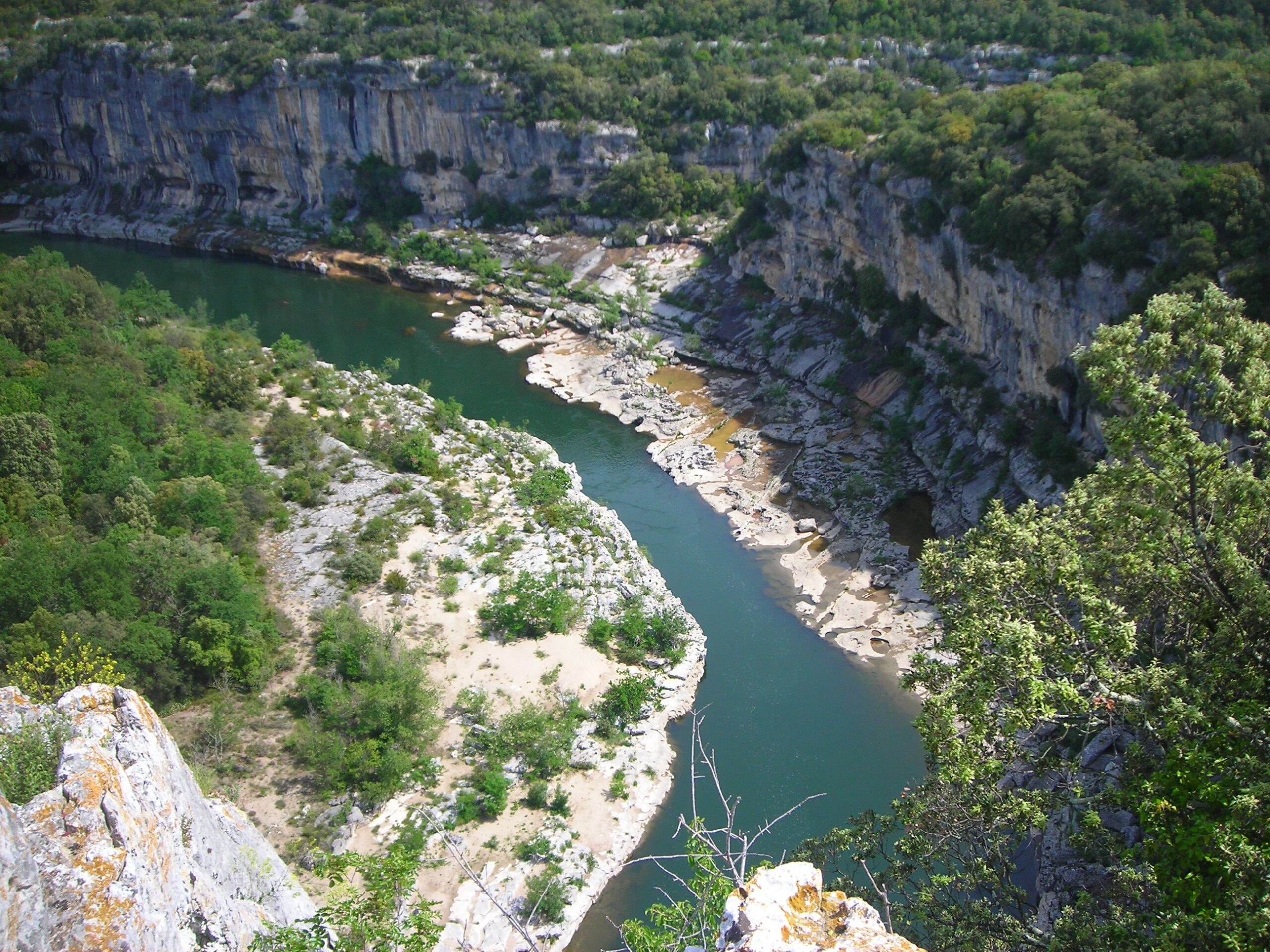
A teal stretch of river at the base of white cliffs topped with trees and plants in the south of France.

A river flowing through a canyon in the south of France. A new study looking at trends in river flows and precipitation between 1951 and 2020 finds that some rivers levels are falling despite overall increases in rainfall. Credit: steinchen on Pixabay.

AGU News

Press registration is open for 2026 AGU Annual Meeting
Press registration is now open for AGU’s 2026 annual meeting in San Francisco, California, convening 7 to 11 December 2026 at the George R. Moscone Convention Center.  Staff, freelance and student journalists are eligible to apply for complimentary press registration until the end of the conference on Friday, 11 December. Press officers and institutional writers covering the meeting are also eligible for press registration.

Featured Research

Rivers losing flow despite receiving more water
A new study charting global flows and precipitation in over 10,000 rivers from 1951 to 2020 has found that 27% have flow trends that don’t match up with how much water they receive from snow and rainfall. 40% of these mismatched rivers get more precipitation now than they did 70 years ago yet are still trending towards lower water levels. Researchers suggest this mismatch may be more common in regions where more water evaporates back into the atmosphere after rainfall and where rainfall extremes are getting more frequent. Understanding what factors besides rainfall control these rivers’ flows will be crucial for predicting future water availability in a changing climate. [Geophysical Research Letters study]

New study finds tighter limits on life beneath the ocean floor
Scientists have long suggested that billions of tons of microbes inhabit cracks and crevices in rock for miles below ground. However, a new study suggests this may be an overestimate, particularly under the oceans. Researchers stitched together global measurements of the temperature gradients in Earth’s crust to find the total area potentially suitable for microbes, which have only been observed to survive up to 122 degrees Celsius. This limit occurs roughly 3 miles (5 kilometers) below land and 1.2 miles (2 kilometers) below the seafloor. This, combined with the biological limits of underground pressure, indicates there could be 5 to 15 times less microbial mass beneath the oceans than previously estimated. [JGR Machine Learning & Computation study]

Waves can supplement — or steal — energy in offshore wind farms
A new study has found that friction between wind and waves can increase or decrease wind speeds at offshore wind turbines by up to 6%, changing a wind farm’s power output. By simulating wave-wind interactions for turbines off the coast of Brazil, researchers found that high wind speeds create choppy seas that increase the water’s drag on the air above, slowing wind down at the height of turbine blades. On the other hand, powerful ocean swells can give the wind a boost from below, increasing potential power output. As offshore wind becomes a larger part of global power production, accurately predicting fluctuations in sea breezes for each wind farm will be key to managing energy supplies around the world. [JGR Oceans study]

Artificially reducing ocean acidity might not lead to long-term carbon storage
A new study finds that between 18 and 59% of the carbon that would be trapped by adding alkalis, substances that can consume acids, to the ocean could leak back out again by the year 10,000. Adding alkalis like quicklime or lye to the oceans would reduce the acidity of seawater, making it easier for carbon-trapping minerals to form and sink to the bottom. Scientists have proposed this could help achieve carbon neutrality by storing carbon on the seafloor for tens of thousands of years. A new study simulated 8,000 years of ocean evolution after adding five billion tons of slake lime per year — the same mass as about 11 Empire State buildings — from 2020 to 2070. Researchers find that adding alkalis could initially bring down atmospheric CO2, but the formation of carbon-trapping minerals would use up the alkalinity after a couple of hundred years, ultimately re-releasing some of the stored CO2. [Global Biogeochemical Cycles study]

The ocean has been “breathing” increasingly heavily over the past four decades
The ocean both absorbs carbon dioxide from the atmosphere and releases it back again in a kind of “breathing” pattern. But according to observations spanning 1982 to 2022, unusually deep inhalations and exhalations (ranking among the strongest 10% of such events from 1982 to 2011) have become more common and intense. While extreme carbon uptake events have gotten more frequent by 1.22 days per decade since 1982, extreme releases of carbon have risen nearly twice as fast, at 2.23 days per decade. Researchers say changes in sea surface temperature are the biggest factor driving these extreme “breaths” and project further increases under strong future warming scenarios. [JGR Atmospheres study]

Four in Five Researchers Report Harmful Interactions During Geoscience Fieldwork. A New Survey Suggests a Path Forward.
A new survey documents the prevalence of harmful interactions that occur during fieldwork. Many instances go officially unreported. [Eos research spotlight] [AGU Advances study]

Tiny Cyanobacteria May Be the Secret Heroes of Ocean Carbon Sequestration
Even when larger phytoplankton produce more carbon, much of it is lost on the journey to the ocean floor. [Eos research spotlight] [AGU Advances study]

Extreme Equatorial Storms are Larger and More Persistent Under Warming
Extreme storms in the tropical regions are expanding and becoming more persistent with climate warming, resulting in higher storm rainfall volumes while peak intensity remains unchanged. [Eos editors’ highlight] [AGU Advances study]

Subscribe or update your subscription preferences

9/10/2026: Forests are marching uphill, potentially destabilizing soil carbon where they arrive

A high rocky peak with patches of snow rises behind a hillside covered in grass and trees under a blue sky.

A high Himalayan peak rises above a tree-covered slope. Climate warming is enabling forests to climb higher in mountainous environments, potentially destabilizing the storage of carbon in alpine soils. Credit: pehrlich on Pixabay

AGU News 

Press registration is open for 2026 AGU Annual Meeting
Press registration is now open for AGU’s 2026 annual meeting in San Francisco, California, convening 7 to 11 December 2026 at the George R. Moscone Convention Center.  Staff, freelance and student journalists are eligible to apply for complimentary press registration until the end of the conference on Friday, 11 December. Press officers and institutional writers covering the meeting are also eligible for press registration.

Arctic Report Card 2026 finds critical support from AGU
The Arctic Report Card, the annual peer-reviewed assessment of the state of the warming Arctic, will continue under its independent editorial team with new support from the American Geophysical Union. The partnership ensures the report’s continuity following the loss of core support from the National Oceanic and Atmospheric Administration. The editorial team, made up of three long-serving Arctic scientists, will continue to lead the Arctic Report Card’s scientific direction and content, with AGU providing critical infrastructure, distribution and convening support. The partners expect the details of this collaboration to evolve as a longer-term governance model is developed over the coming months. [AGU press release] [Eos commentary] [Arctic Report Card website]

Featured Research

Forests are marching uphill, potentially destabilizing soil carbon where they arrive
As the climate warms, forests previously confined to lower elevations can grow ever higher in mountainous regions. By gathering soil samples high in the Bhutanese Himalaya, researchers found that as trees encroach into alpine areas, the amount of carbon durably stored in the soil drops by almost 30%. The overall decline in stable soil carbon raises concerns that the lofty new forests may not be as reliable for long-term carbon storage as the high alpine ecosystems they are replacing. [JGR Biogeosciences study]

Water likely prevented young Mars from developing plate tectonics
Even small amounts of water in Mars’ early crust — less than half a percent, by weight — would have been enough to keep Martian rocks too light and buoyant to sink below those around them, according to recent model simulations. On Earth, puzzle pieces of planetary crust slide over or under each other due to some being dense enough to sink below others, a process known as subduction-driven plate tectonics. Water doesn’t prevent subduction on Earth due to differences in the material and thermal properties of the two planets’ crusts, the researchers say.  On early Mars, however, the likely presence of water on early Mars could have contributed to the lack of this phenomenon on the red planet. The finding held up across various types, temperatures, and thicknesses of Martian crust. [JGR Planets study]

Impacts can give a planet an atmosphere — or take it away
When a comet or asteroid strikes a planet’s atmosphere, two competing effects come into play. The impactor brings extraterrestrial material, including rock, water, carbon dioxide and nitrogen, some of which can add gas to the atmosphere. The force of the impact, on the other hand, can eject some of the planet’s existing atmosphere. By simulating the effects of pummeling early Earth, Mars and Venus with a realistic range of impactors zipping around the solar system, researchers found an enormous range of possible outcomes. Earth’s atmosphere tended to grow, whereas Mars’ could either grow or shrink. The study confirms that impacts are a crucial source of gases for planets’ atmospheres but highlights how much work remains to understand how Earth’s atmosphere ended up just right, compared to the punishingly thick Venusian and perilously thin Martian ones. [JGR Planets study]

Drones reveal hidden hazards in Icelandic town shaken by volcanos
Since November 2023, the town of Grindavík in western Iceland has been an epicenter of volcanic activity as molten rock works its way closer to the surface. The resulting tremors and earthquakes have opened sinkholes and fractures under streets and playgrounds. Many of these hazards don’t breach the surface, rendering them effectively invisible and thus even more dangerous. For the first time, researchers have deployed a combination of on-the-ground and drone-based geophysics measurements to map out unseen pits and voids up to nine feet (three meters) wide and as far as 30 to 60 feet (10 to 20 meters) below ground. This new technique could provide near-real-time info on urban hazards during volcanic activity, protecting towns from literally falling into the ground. [Geophysical Research Letters study]

Moon soil gets more insulating as it ages
A new study has found that the oldest lunar soil — known as regolith — is two times worse at conducting heat than younger, fresher soil. The tiny fragments of rock on the moon’s surface weather constant bombardment by meteorites, cosmic rays and solar wind, which break them apart, fluff them up, and change their chemistry. With enough time, this riddles the soil with microscopic gaps filled with the vacuum of space, which works like millions of tiny insulating flasks that prevent heat from conducting from grain to grain. Since the insulating effect strengthens with soil age, infrared instruments on orbiting spacecraft can use it to map soil age Moon-wide. Based on these results, China’s Chang’e-5 mission will be landing on younger lunar soil than Chang’e-6, which will be important for interpreting the geology at each location. [JGR Planets study]

What will the future of Alaskan wildfire look like?
More and larger fires, including in areas of historically low fire activity, are likely but not a given. [Eos research spotlight] [Earth’s Future study]

The economic costs of solar storms
Though less present in the public consciousness than hurricanes and wildfires, space weather represents a real and potentially significant threat to society. [Eos research spotlight] [AGU Advances study]

Subscribe or update your subscription preferences

9/3/2026: Hot droughts trigger harsher rains

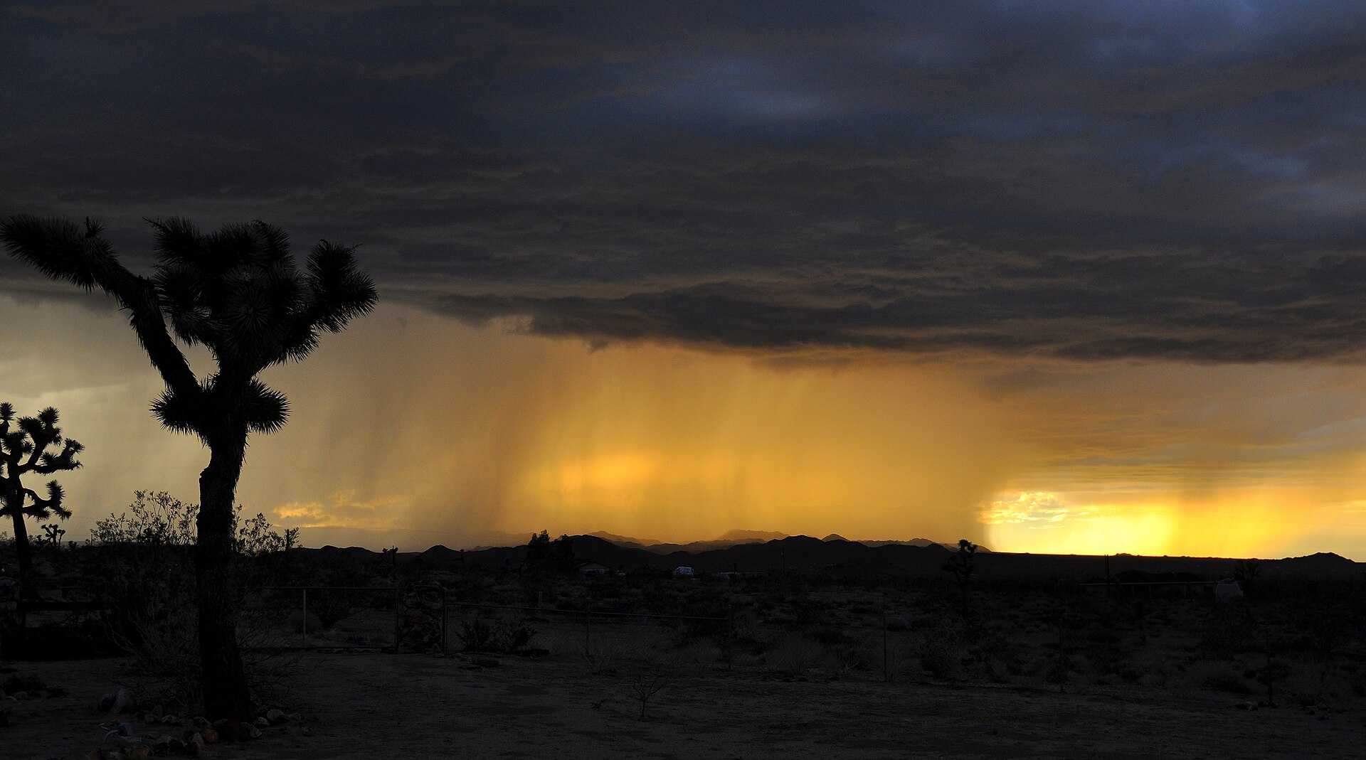
Heavy rain falling on desert hills beneath a sky of dark clouds in the Mojave with a Joshua Tree in the foreground.

Heavy rain inundating California’s Mojave Desert. Extreme downpours right after hot droughts are more intense than the rains that follow cooler droughts, according to a new study.  Credit: Jessie Eastland via Wikimedia Commons.

Featured Research 

Hot droughts trigger harsher rains
A new study finds that bursts of extreme rainfall occur 66% to 315% more often after hot droughts than after non-hot droughts. Based on weather data from 1979 to 2023, every hot drought has about a 45% chance of potentially damaging wet conditions ensuing. When this whiplash occurs, the resulting rain starts 10% sooner, gets 14% heavier, and lasts 12% longer on average compared to rains after cooler droughts. Researchers project that future greenhouse warming will make this drought-to-downpour whiplash more common, ramping up the strain on infrastructure, agriculture and ecosystems alike. [Earth’s Future study]  

Spacecraft nearer the Sun can help warn of solar storms 3 to 13 hours sooner 
Space weather like solar storms can fry satellites, damage power infrastructure, and cause communication blackouts. Currently, space weather predictions and warnings are based on observations from spacecraft close to Earth, which can only detect incoming events 10 to 80 minutes before they arrive. A new study used data from a satellite much further away — ESA’s Solar Orbiter mission, sent in part to take the closest-ever images of the sun — to successfully predict the effects of two 2024 space weather events 4.3 and 15.3 hours before they reached Earth. Future monitoring spacecraft could use a similar approach to provide hours — not minutes — of warning. [Space Weatherstudy]  

Staying below 1.8 C of warming could spare 7% of the Amazon from higher fire risk
A new study finds that extremely hot, dry conditions associated with a high risk of wildfires occurred on at least 3 days per year across over half of the Southern Amazon between 2001 and 2023, compared with just over a tenth of the region between 1979 and 2001. On average, the number of days of wildfire risk has also risen, with some areas now experiencing 30 or more high fire risk days per year. Researchers attribute the increase to human carbon emissions and predict that these extremes will become even more common by 2100. Compared to the current emissions trajectory towards 2.7 degrees C of climate warming, staying below 1.8 C would reduce the forested area with over 30 days of wildfire conditions per year in 2100 from 22% to less than 15%. [Geophysical Research Letters study] 

Deepest-ever Moon rock sample survived shock of becoming a meteorite
In 2017, a meteorite dealer sold a moon fragment from the North African desert containing an unassuming brown blob whose mineral makeup suggests it comes from 55 miles (88 kilometers) below the moon’s surface — the deepest ever lunar sample from any mission or meteorite. Scientists feared that the shock of being thrown from the moon by a violent impact may have corrupted the sample, rendering it useless for understanding the chemical composition deep inside the Moon, which holds clues to the moon’s evolution. A new study has scrutinized the cracked and warped mineral grains of the meteorite and found that the damage doesn’t appear to be destructive — the sample still likely preserves the chemistry of the deepest part of the moon scientists have ever seen. [Journal of Geophysical Research Planetsstudy]  

An Antarctic path to better sea-level rise projections, outlined by scientists
80 scientists from 17 countries agree: we need a better understanding of how the Antarctic Ice Sheet is losing ice along its coastal margin to better predict sea level rise. The ice sheet, expected to continue shrinking as the climate warms, is the largest source of uncertainty in current sea-level rise projections. After reviewing current knowledge of the sheet’s coastal zone — where interactions between ice, land, and ocean can produce outsized impacts on ice loss — the scientists identified the most significant gaps in our understanding of those interactions, including the topography of bedrock below coastal ice. The team calls for coordinated international efforts to fill those gaps. [SCAR press release] [Reviews of Geophysicsstudy]  

Did ocean motion carve Enceladus’s tiger stripes?
Wobbles of the moon’s icy shell may set off waves in the subsurface ocean that sculpt water-spewing fissures from beneath. [Eos research spotlight] [AGU Advances study]

Subscribe or update your subscription preferences

8/20/2026: Climate change will likely make boreal forests more deciduous, less evergreen

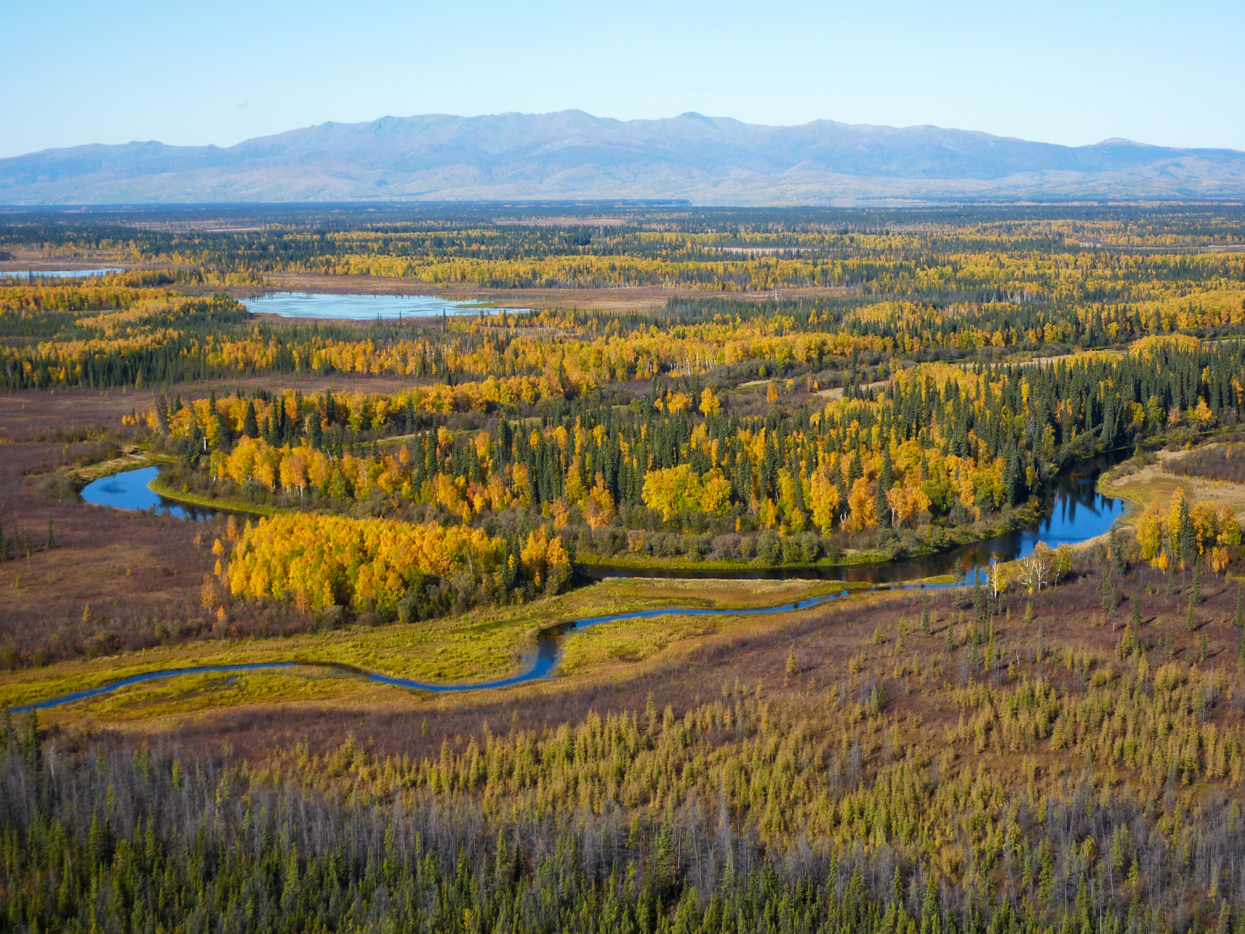
Aerial view of green evergreen trees and yellow deciduous trees along the Yukon River in Alaska with hills in the distance.

Mixed deciduous and evergreen boreal forest on the banks of the Yukon River, Alaska. As forests recover from disruptions like fires and storms, warming temperatures give deciduous trees a leg up over evergreens in some areas, which researchers anticipate will change the makeup of forests in the future. Credit: United States Fish and Wildlife Service (USFWS) Alaska on Wikimedia Commons.

Featured Research

Climate change will likely make boreal forests more deciduous, less evergreen
As climate change brings more fires, storms and other disturbances to boreal forests, warmer temperatures will likely give deciduous trees a leg up, allowing them to outcompete evergreens in some places as those forests regrow. How a forest regrows in the first decade after a fire or storm can predict a long-term shift to deciduousness with 90% accuracy, a new study finds. However, while deciduous trees may dominate certain areas for longer periods, they probably won’t take over permanently. The findings, from recent model simulations of forest recovery under climate scenarios through the next century, adds to a growing body of evidence that warming may restructure boreal forests by favoring deciduous trees where evergreens once reigned. [JGR Biogeosciences study]

Largest-known lunar shield volcanoes revealed
Researchers have identified two 50-mile-wide (80-kilometer-wide) shield volcanoes — a type of wide, rounded volcano with shallow sloping sides — on the Moon. The Prinz-Harbinger and Theophilus volcanoes are more than double the size of any previously known lunar shield volcano and around 25% larger than Earth’s most famous one, Mauna Loa. For these volcanoes to form, large volumes of magma must have collected close to the lunar surface, a process previously thought to be unlikely on the Moon. Researchers suggest large meteor impacts could have created networks of cracks that enabled magma to flow towards the surface. [Geophysical Research Letters study]

Stacking droughts worsen wildfires
Flash droughts — events where the amount of water in the soil drops sharply below the previous 20 days’ average — can stack on top of multi-year dry conditions, creating a one-two punch that can desiccate vegetation and prime the land for fire. A new study examining global fire and moisture data from 2002 to 2021 shows that fires that burned under combined flash and standard drought moved 3% faster, grew 21% larger and lasted 8% longer on average than fires during long-term standard drought conditions alone. Researchers suggest that monitoring for flash droughts could improve early detection of high fire risk conditions, especially as climate change drives up temperatures and makes sudden dry conditions more common worldwide. [Geophysical Research Letters study]

This CubeSat lost a week of its life to a solar storm, falling 1.5 miles towards Earth
A Slovenian CubeSat satellite known as TRISAT drifted over 1.5 miles (2.5 kilometers) closer to Earth in four days during the powerful geomagnetic storm of May, 2024, cutting about a week off its operational lifespan. Satellites’ orbital tracks naturally shrink over time, but geomagnetic storms can heat and expand the Earth’s upper atmosphere, increasing drag on satellites and causing them to slip back towards Earth. In a recent study, researchers write that low-orbit satellites without their own propulsion systems, like CubeSats, take the biggest hits: TRISAT saw its orbital decay rate more than double during the 2024 storm’s peak impact. Besides shortening satellites’ operational lifespans, accelerated orbital changes like this can make it harder for scientists to accurately predict satellites’ orbits and safely manage satellite traffic. [Space Weather study]

A goldilocks zone to maximize wetlands’ warming-mitigation abilities
Temperate wetlands have the greatest cooling effect on the climate when water levels hover near the soil surface, a recent study finds. Leave it too dry or too flooded, and the system doesn’t store as much carbon, while inundation up to a point can cause wetlands to belch more methane, another greenhouse gas. The findings come from data on gas movement at 43 wetlands across a range of climates around the world. Because wetlands play both cooling and warming roles — absorbing CO2 but releasing methane — land managers hoping to maximize the net cooling effect may want to focus on managing water tables, such as by rewetting degraded wetlands, the researchers write. [Geophysical Research Letters study]

Extreme Heat May Drive Asthma Risk in Baltimore, Especially at Night
A new study paints a fuller picture of how heat affects respiratory health, especially in Baltimore’s socially vulnerable neighborhoods. [Eos Research Spotlight] [GeoHealth study]

Subscribe or update your subscription preferences

8/6/2026: Tree canopy losses associated with mortality in Chicago

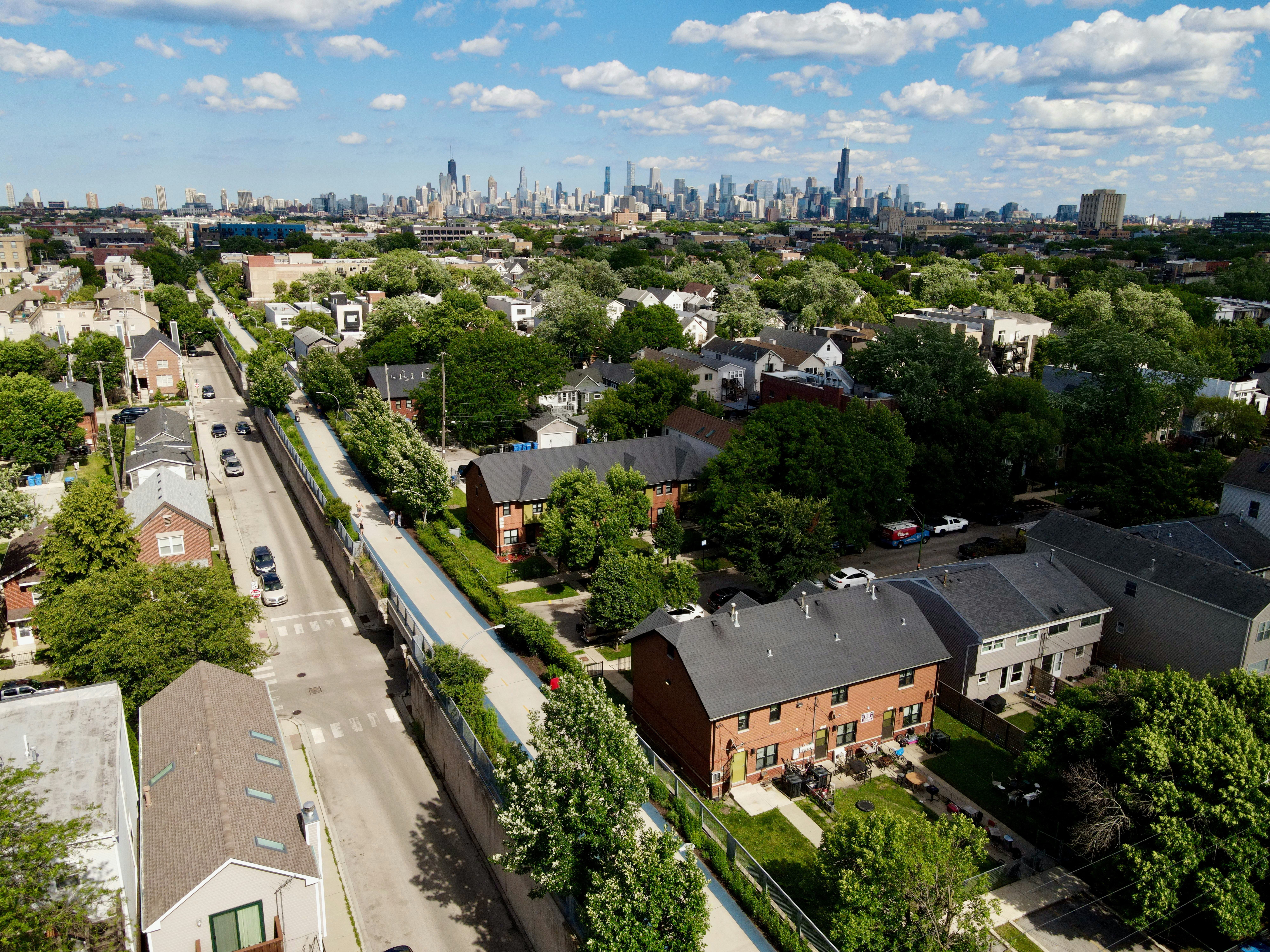
Tree-lined streets and a variety of residential buildings surrounded by vegetation in a Chicago neighborhood, with the city skyline on the horizon.

A leafy neighborhood in Chicago, looking towards the city. A new study has found that neighborhoods with growing canopy cover see fewer annual deaths from a wide range of diseases compared to neighborhoods where tree cover is shrinking over time. Credit: Shep McAllister on Unsplash.

Featured Research

Tree canopy losses associated with mortality in Chicago
Death rates drop in Chicago neighborhoods where tree cover expands year-to-year and rise in those where it declines, including from heart, lung, musculoskeletal and mental health diseases. Researchers estimate that growing the city’s canopy by 0.03% (about 14,000 trees) per year would be associated with 105 fewer annual deaths, with hotter neighborhoods benefiting the most from added tree cover — though, they note, the study did not prove a direct causal link between canopy changes and mortality. Crucially, the team found that the total amount of canopy at any given time appears less important than how much the canopy changed over the 2011 to 2021 study period: in the hottest neighborhoods, on Chicago’s South and West sides, mortality rose as canopy fell despite a relatively high baseline of tree cover. [GeoHealth study] [Northwestern University press release]

In heat and drought, planted and natural forests may be stronger together than alone
When extreme heat and drought both struck the Yangtze River Basin at once in 2022, the region’s forests didn’t all react the same way. In most areas, human-planted forests took hard hits during the extreme event but bounced back quickly the following year, while their natural counterparts suffered less but took longer to return to full health. The more extreme the conditions, researchers noticed, the greater the difference: natural forests’ superior height, mass and diversity granted resilience upfront, while planted forests’ youth conferred recovery potential. Managing forests to maintain the diversity found in natural areas, rather than planting monocultures, may capture the best of both worlds as climate change continues, the researchers write. [Water Resources Research study]

Warming helps Arctic plants in the early season but hurts them down the road
High temperatures tend to boost Arctic plant growth early in the growing season but stifle it later in the year if heat and dry soils persist, according to a recent study of Arctic ecosystem productivity between 2000 and 2022. Although regional and interannual differences exist, the researchers wrote, the overall pattern makes taiga and tundra more vulnerable and weakens their carbon storage abilities as climate change warms the Arctic at a disproportionate rate. [Geophysical Research Letters study]

Storms erode a New Jersey beach twice as often as 47 years ago
At a beach in Sandy Hook, New Jersey, U.S.A, storms large enough to eat away over 86 square feet of beach area in 48 hours now happen two to three times a year, up from one or two times a year in the late ‘70s. Researchers on the beach used radar to find buried layers of coarse sand, shells and pebbles — evidence of erosive storms from 2009 to 2019 — then ran simulations to see what kind of storm conditions likely produced those layers and how common those conditions have gotten over time. The team hopes their method can help other coastlines unpack their storm histories to improve beach management as strengthening storms and rising sea levels stress coastal communities. [Earth’s Future study] [Rutgers University press release]

Sand and gravel mining consumes riverbeds to feed global concrete appetite
In 2024, the world turned about 28 billion metric tons of sand and gravel — by far the most-mined solid materials on Earth — into concrete. Urbanization, population growth and infrastructure development have driven demand above the capacity of natural systems to replenish the resource, according to a new review that digs into where mining is happening and its social and environmental consequences. Taking too much risks riverbanks collapsing, water quality degrading, groundwater levels dropping and salt water intruding into coastal waterways. Though demand is global, China and India currently consume the most and extraction is most intensive in Asia and Africa. [Reviews of Geophysics review] [Eos Editor’s Vox] [Nanyang Technological University press release]

How Water Flows Toward Cities During Hurricanes
Topography is a key factor exacerbating compound flooding, while coastal wetlands help protect cities. [Eos Research Spotlight] [Geophysical Research Letters study]

How Does Social Vulnerability Evolve After a Tropical Cyclone?
An initial rise in the social vulnerability index is followed by a decrease, but that decrease comes with a catch. [Eos Research Spotlight] [GeoHealth study]

Subscribe or update your subscription preferences

7/9/2026: Tropical cyclones suck the atmosphere dry

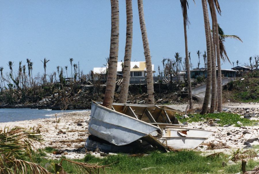
A damaged boat on a beach after a cyclone on a sunny day with trees, coastline and a building in the background.

The aftermath of 1991 Cyclone Val in Western Samoa. Despite the intense rainfall during cyclones, drier conditions follow as winds blow in moisture-starved air in the wake of the storm.

Featured Research

Tropical cyclones suck the atmosphere dry
After a tropical cyclone hits, trailing winds blow in dry air in the storm’s wake, leading to a two-week calm after the storm where the chance of rain drops by 15-18% compared to non-cyclone conditions. Tropical cyclones are thirsty — sustaining multiple days of intense rain not only uses up all the water in the immediate area of the storm but also requires stealing moist air from the storm’s surroundings. This creates a trail of dry air that is blown in after the cyclone leaves, briefly changing the local water cycle. [Geophysical Research Letters study]

Climate models at risk of overestimating carbon storage by trees
The land surface absorbs about a third of human carbon dioxide emissions, but future drying could reduce that capacity. New research finds the impact of dry spells on Europe’s trees has been underestimated by a factor of 2 to 3 under 4.5 degrees of warming. Dry conditions restrict how quickly trees can incorporate carbon by growing new wood. When this limit is accounted for, Europe’s forests are projected to store up to 30% less carbon by 2069 than they did from 2005-2014. Researchers warn that many climate models are missing this drying effect on trees, which may mean climate projections are overestimating carbon removal. [Geophysical Research Letters study]

Future fire smoke could erase decades of air quality improvements in southwestern China
Smoke from increasing future fires is projected to cause more than 40,000 additional premature deaths in the Indochina Peninsula and southwestern China between 2058 and 2060, according to a new climate modelling study. Warmer temperatures, drier conditions, and changing wind patterns are expected to trigger more fires in the Indochina Peninsula, increasing downwind particulate concentrations by up to 58%. By 2060, smoke is expected to erase the air quality gains expected from emissions reductions in China. [JGR Atmospheres study]

Warming to worsen water cycle whiplash across the UK
When an area flips rapidly between drought and flood conditions, the water whiplash leads to increased flash flooding, declining water quality, and other costly and disruptive impacts. A new study of precipitation and river flows across the U.K. projects that combined dry and wet extremes — including dry spells up to 20 days longer and 6-40% increases in the risk of extreme flooding — will stack to cause parts of the U.K. to experience up to 5 more whiplash events every 30 years if the world warms 4 degrees Celsius. Although historically wet areas will generally get wetter, and dry areas drier, increased swings between extremes nationwide will require infrastructure adaptations that can cope with both too much water and not enough. [Earth’s Future study]

Malaria rebounds within years of control program ending in rural Brazil
New research found that cases of malaria rose by over 1000% in rural areas of the Brazilian Amazon, putting forest-edge communities at the highest level of risk after local programs stopped. This study offers a stark, data-driven warning about the impact of interruptions to malaria control programs and the critical role of landscape epidemiology in achieving and maintaining malaria elimination in Amazonian settings. [GeoHealth study]

Reconnecting to the Lunar Trailblazer with Light
Learning from the attempted rescue of the Lunar Trailblazer: how ground-based optical observations and laboratory measurements can improve recovery of the attitude of a spacecraft lost in space. [Eos editors’ highlight][Earth and Space Science study]

The Largest Ice Thickness Survey of Alaska’s Glaciers
A decade of NASA airborne radar surveys produces the most extensive inventory of glacier ice thickness for Alaska and northwestern Canada to date. [Eos editors’ highlight][Journal of Geophysical Research Earth Surface study]